More time for adventures with this premium, durable GPS handheld and satellite communication device. You get inReach® technology that enables two-way messaging, interactive SOS alerts, and location sharing1, as well as maps to keep you on track.
Key features:
- Using multiple global satellite systems (GPS and GALILEO) allows tracking even in more challenging environments than with GPS alone.
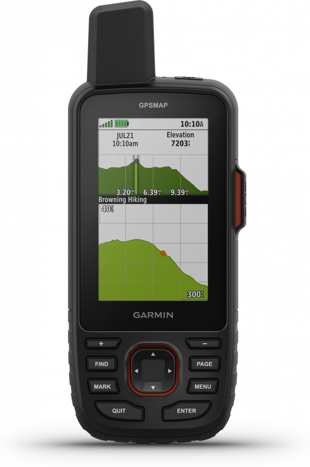
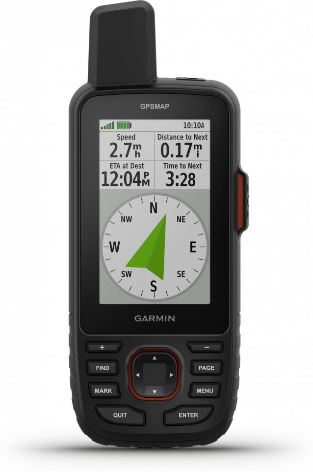
- Navigate your next route with ABC sensors: altimeter, barometer for weather monitoring, and a three-axis electronic compass.
- Download accurate, realistic maps directly to the device via Wi-Fi® technology. You can easily search for trails, select camping and parking spots, and create waypoints.
- Download accurate and realistic maps directly to the device without an annual subscription. Search trails, select camping spots, find parking, create waypoints, and much more.
- Preloaded TopoActive Europe maps show peaks, parks, shorelines, rivers, lakes, and geographic points.
- With an Outdoor Maps+ subscription, access public land information, landowner names, state parcel maps, hunting management unit boundaries, and BLM boundaries.
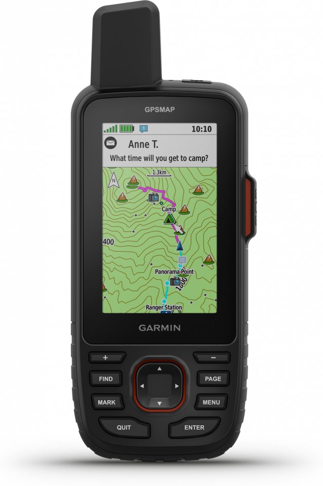
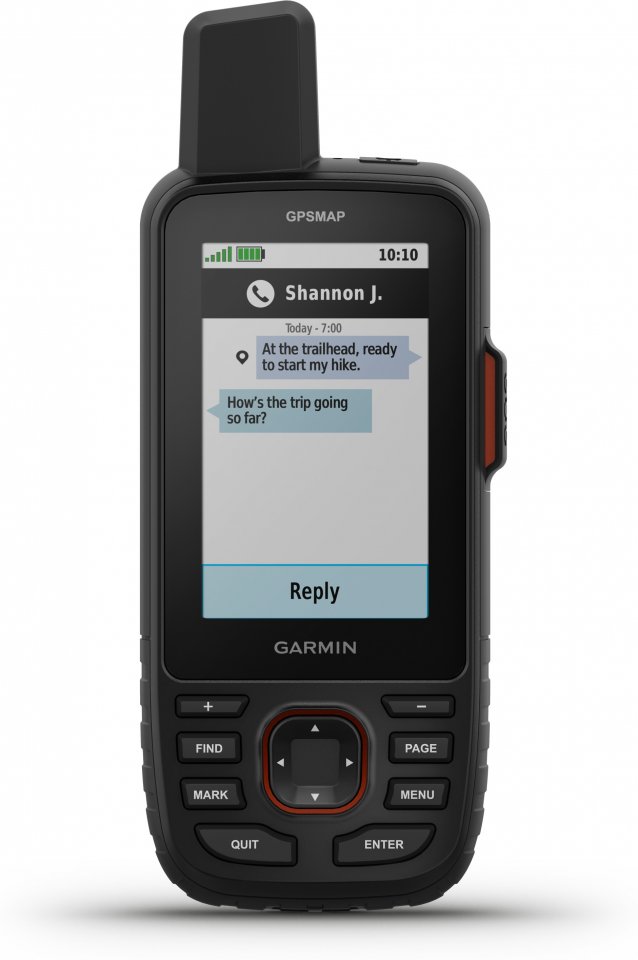
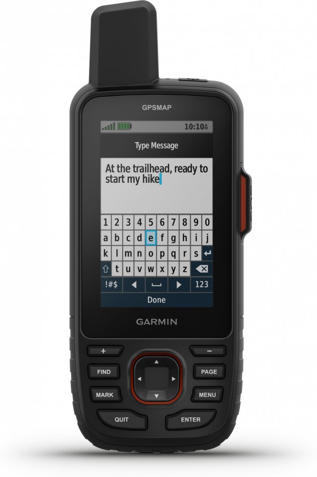
- You can send text messages to loved ones, post messages on social media, or message from inReach device to device in the field. Requires satellite subscription.
- In power-saving mode, the battery lasts up to 425 hours when using inReach technology. In default tracking mode, battery life is up to 165 hours, with location recorded every 10 minutes.
- You can send text messages to loved ones, post on social media, or message from inReach device to device in the field.
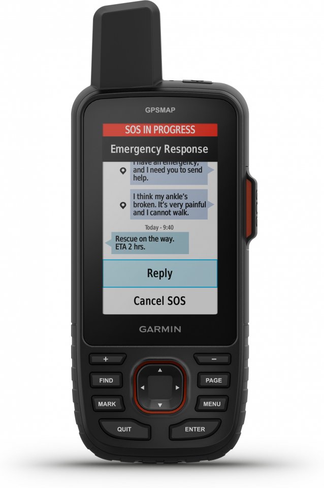
- In an emergency, you can send an interactive SOS message to the Garmin ResponseSM center, a professional emergency services coordination center that is always open.
- Track your location and share it with people at home or in the field. They can follow your progress, request GPS location from your device, and much more.
- Instead of cellular networks, messages, SOS alerts, and tracking data are now transmitted via the global Iridium satellite network.
- By downloading the Garmin Messenger app to a compatible smartphone and pairing it with the GPSMAP® 67i device, you get fast and smooth messaging functions and 24/7 SOS functionality that is not limited to mobile network coverage areas1. The app also supports group messaging.
- Plan, review, and sync waypoints, routes, and tracks with the Garmin Explore app and website. You can also review performances in the field.
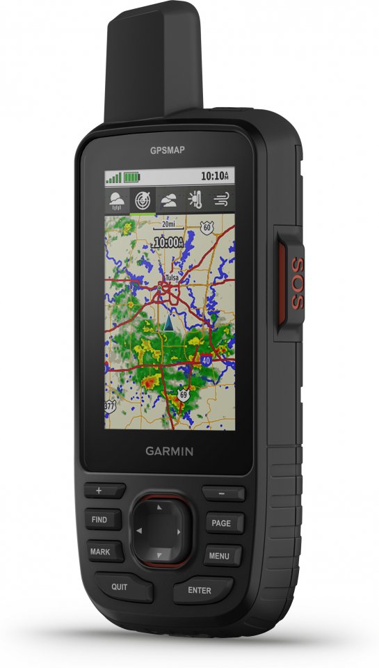
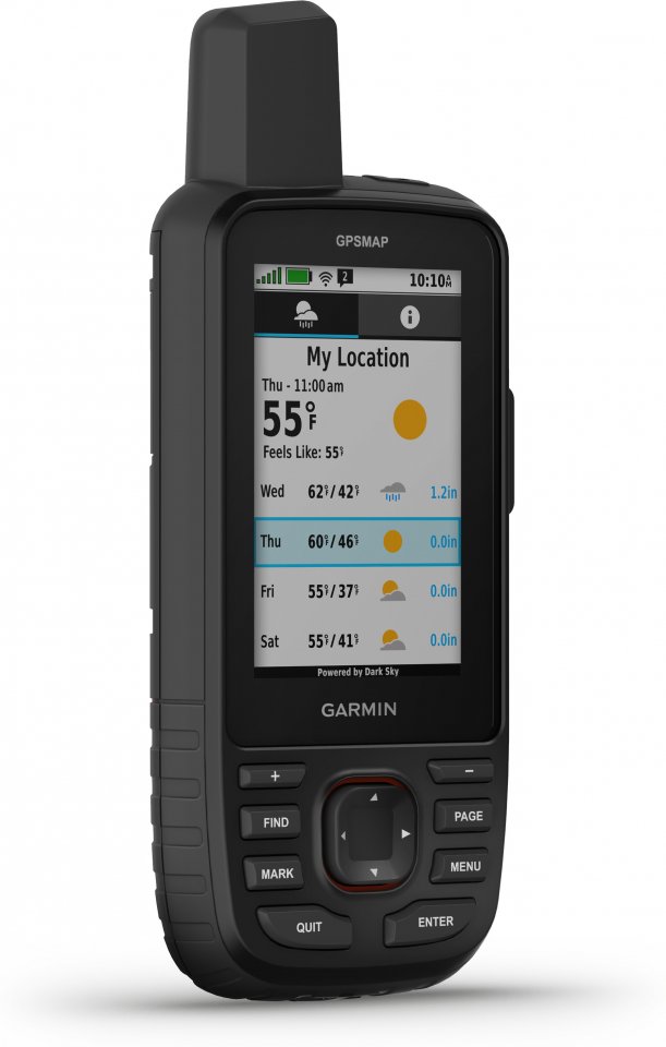
- With inReach connectivity, get accurate weather information on the GPSMAP 67i handheld. Request current location or weather forecasts for waypoints or destinations on your route.
- When paired with the Garmin Explore smartphone app, receive real-time forecast updates to stay aware of changing conditions.
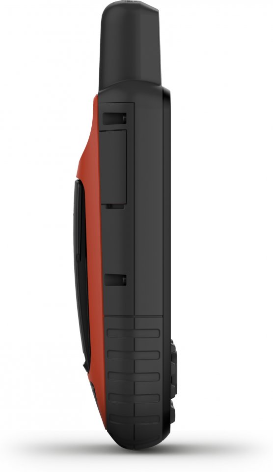
- The handheld’s heat, shock, and water resistance are military-grade (MIL-STD-810G), and it also supports night vision goggles.
- The GPSMAP 67 series can reduce the amount of gear you carry. It includes a built-in LED flashlight.
- Take advantage of Geocaching Live automatic cache updates such as descriptions, logs, and hints. When connected via Wi-Fi or the Garmin Explore™ smartphone app, each find is uploaded to your Geocaching.com profile.
Technical specifications:
- Display: transflective TFT, 3.8 x 6.3 cm, 7.6 cm (3 inch) diagonal, 240 x 400 pixels
- Preloaded TopoActive Europe maps with routing-supported roads and trails for cycling and hiking
- Waypoints/favorites/locations: 2000
- Routes: 250
- Log: 10,000 track points
- Tracks: 250
- Area measurement
- Battery: rechargeable Li-Ion
- Battery life:
- Up to 165 hours with inReach® using 10-minute tracking intervals
- Up to 180 hours in GPS mode
- Up to 425 hours in power-saving mode with inReach active
- Up to 840 hours in power-saving mode
- Memory: 16 GB internal memory
- Memory card slot: microSD (max 32 GB)
- GPS
- GALILEO
- Barometric altimeter
- Compass (tilt-compensated, three-axis)
- Flashlight
- Connectivity: Wi-Fi, Bluetooth, ANT+
- Dimensions: 6.2 x 16.3 x 3.5 cm
- Weight: 230 g with batteries
- Water rating: IPX7, MIL-STD-810
- Connections: USB-C, NMEA 0183 compatible
In the box:
- GPSMAP 67i handheld
- Type A–Type C USB cable
- Carabiner clip
- Manuals