| Country of Origin | United States |
|---|---|
| PID | 863566 |
| Product depth (mm) | 103 |
| Product height (mm) | 33 |
| Product weight (g) | 142 |
| Product width (mm) | 54 |
| Display size (inches) | 2,2 |
| Battery type | AA |
| Electronic address of single contact point | |
| Manufacturer address | "GARMIN Corporation, Street: No.68 Zhangshu 2nd Rd, Xizhi Dist, Postcode:221, City: New Taipei City 221, Country: TAIWAN, R.O.C / GARMIN Würzburg GmbH, Street: Beethovenstraße 1 a+b, Postcode: 97080, City: Würzburg, Country:Germany " |
| Manufacturer's email address | |
| Manufacturer name | GARMIN Corporation / GARMIN Würzburg GmbH |
| EU Responsible Person | GARMIN Würzburg GmbH, Street: Beethovenstraße 1 a+b, Postcode: 97080, City: Würzburg, Country:Germany |
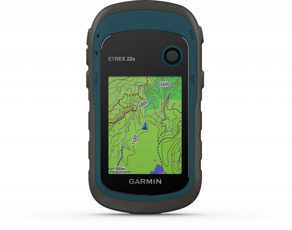
Explore with a reliable GPS handheld device.
Ensure visibility
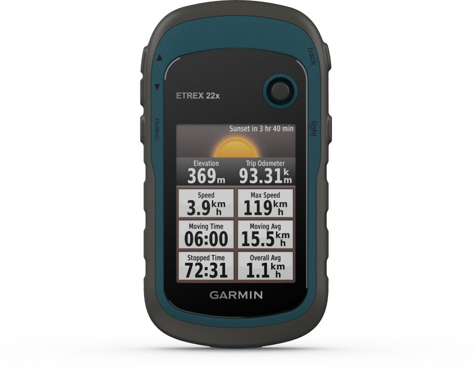
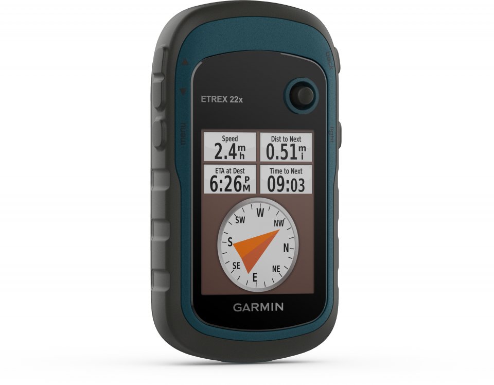
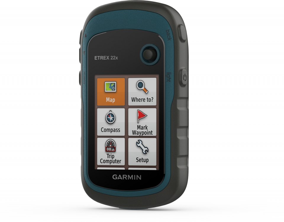
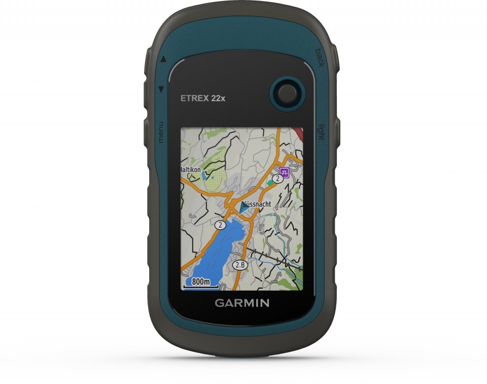
The eTrex 22x device features an improved 2.2-inch, 65,000-color display that is readable even in sunlight. The durable and waterproof handheld device is unfazed by natural elements.
Discover the terrain
The eTrex 22x handheld comes preloaded with TopoActive Europe maps supporting route navigation, showing streets and trails so you can also travel off-road. Now you know your surroundings, including waterways, natural features, buildings, and country borders. Additionally, you can search among thousands of points of interest such as shops, restaurants, universities, parking areas, and accommodations.
Keep your location
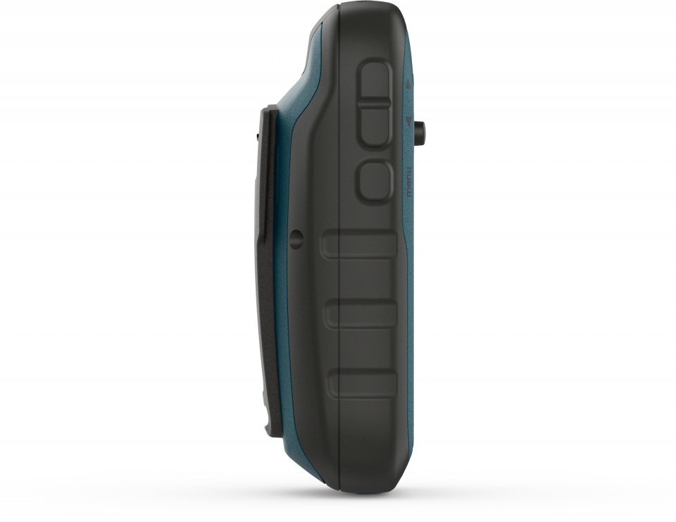
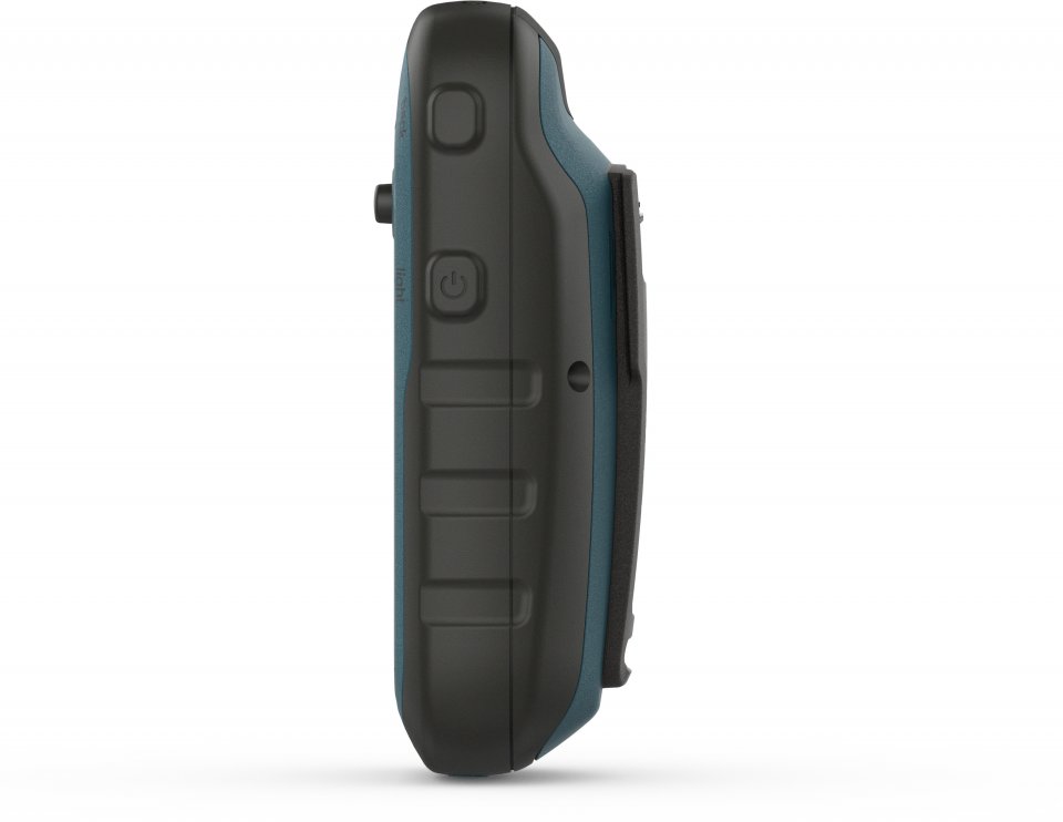
eTrex series devices use both GPS and GLONASS satellite systems, so the receiver can provide positioning in more challenging environments than using GPS alone. The eTrex 32x adds a three-axis compass and barometric altimeter to keep you informed of your location.
Add more maps
Thanks to the MicroSD card slot and expanded 8 GB internal memory, you can easily download additional maps for the areas your adventures take you. Purchase detailed Finland TOPO Finland v5 PRO maps here.
Satellite images
The Garmin eTrex 22x supports BirdsEye satellite images (subscription required), allowing you to download satellite images along with maps and add images to maps.
Find entertainment
eTrex 22x supports paperless geocaching. Download GPX files directly to the device and view key information such as location, terrain, and hints from Geocaching.com.
Travel anywhere
With various compatible mounts, the eTrex GPS handheld can be conveniently used for ATV riding, cycling, boating, or walking. The car mount and City Navigator® NT maps provide turn-by-turn driving directions, and the sturdy mount allows you to attach the device to a motorcycle or ATV. eTrex devices have suitable maps and mounts for all uses.
The eTrex 32x additionally includes a three-axis compass and barometric altimeter.
Technical specifications:
In the sales package:
Explore with a reliable GPS handheld device.
Ensure visibility
The eTrex 22x device features an improved 2.2-inch, 65,000-color display that is readable even in sunlight. The durable and waterproof handheld device is unfazed by natural elements.
Discover the terrain
The eTrex 22x handheld comes preloaded with TopoActive Europe maps supporting route navigation, showing streets and trails so you can also travel off-road. Now you know your surroundings, including waterways, natural features, buildings, and country borders. Additionally, you can search among thousands of points of interest such as shops, restaurants, universities, parking areas, and accommodations.
Keep your location
eTrex series devices use both GPS and GLONASS satellite systems, so the receiver can provide positioning in more challenging environments than using GPS alone. The eTrex 32x adds a three-axis compass and barometric altimeter to keep you informed of your location.
Add more maps
Thanks to the MicroSD card slot and expanded 8 GB internal memory, you can easily download additional maps for the areas your adventures take you. Purchase detailed Finland TOPO Finland v5 PRO maps here.
Satellite images
The Garmin eTrex 22x supports BirdsEye satellite images (subscription required), allowing you to download satellite images along with maps and add images to maps.
Find entertainment
eTrex 22x supports paperless geocaching. Download GPX files directly to the device and view key information such as location, terrain, and hints from Geocaching.com.
Travel anywhere
With various compatible mounts, the eTrex GPS handheld can be conveniently used for ATV riding, cycling, boating, or walking. The car mount and City Navigator® NT maps provide turn-by-turn driving directions, and the sturdy mount allows you to attach the device to a motorcycle or ATV. eTrex devices have suitable maps and mounts for all uses.
The eTrex 32x additionally includes a three-axis compass and barometric altimeter.
Technical specifications:
In the sales package: